A first estimate of Peloponisos fires using satellite images AVHRR-18
Preparation: Dr. Evaggelos Papapanagiotou (Sept. 10, 2007)
Today's and Previous Satellite Images of MODIS
Aqua/Terra In the following screen select resolution of: 10Km | 5km |
1km | 500m | 250m
Point Weather and Sea Wave Height Prediction From the Group of Atmospheric Sciences of the University of Athens. Left click and hold the mouse button on the cursor and move to the point you wish to get the weather prediction. Move the cursor to the sea to get prediction of the wave height and the wave characteristics.
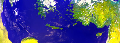
Satellite image AVHRR 18 (Bands 1,2,4) September (2-9-2007 12:26 GMT) of Southern Greece.
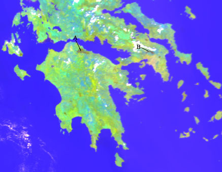
Part of a Satellite image AVHRR in August of the wider area in Peloponnesus after been georeferenced to the Greek datum EGSA87. The white areas are clouds, while it is visible with brown color the burned areas (A) in Aigialeia and (B) in Parnitha.
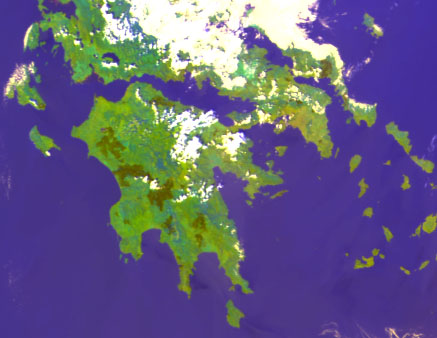
Part of a Satellite image AVHRR in September of the wider area in Peloponnesus after been georeferenced to the Greek datum EGSA87. The white areas are clouds, while the dark green colored areas are recently burned areas.
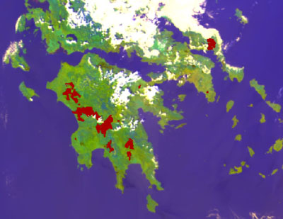
Result of automated recognition of burned areas (red color) between August 20th and September 2, 2007 (the background is an AVHRR image of September). The results do not show the burned areas of Aigialeia and Parnitha as been before the image acquisition period.
A/A |
Land Cover Type |
Area/1000m2 |
|---|---|---|
1 |
Urban Environment |
7.728 |
2 |
Places for athletes with vegetation |
457 |
3 |
Non watered agriculture |
20.923 |
4 |
Vine yards |
8.361 |
5 |
Orchards |
449 |
6 |
Olive groves |
80.427 |
7 |
Complex agriculture areas |
128.939 |
8 |
Substitution of agriculture areas with shrub |
321.352 |
9 |
Broad leave forests |
70.547 |
10 |
Conifer forests |
67.152 |
11 |
Mixed conifer and broad leave forests |
68.200 |
12 |
Grasslands |
98.656 |
13 |
Brush |
205.785 |
14 |
Areas between forest and brush |
152.274 |
15 |
Coastal vegetation |
3.411 |
16 |
Wetlands of salt and sweet water |
1.875 |
17 |
River vegetation |
988 |
18 |
Lake vegetation |
4.710 |
|
TOTAL |
1.248.523 |